There is only the Road. Realised I had no recollection of Oklahoma City. Had to read it up in the guide book. So, no pics. I drove around for ages to find the route out and lost the will. It does have a magnificent OTT Capitol, I recall, which is approached by a boulevard worthy of Paris. One does wonder if they are over-compensating.
Leaving the city, you skirt a large lake complete with geese.
Yukon (named for the gold rush in Canada that was happening when the town was founded) is well known for its giant grain elevator, the cathedrals of OK. It also proclaims itself to be the "Czech Capital of Oklahoma". According to Wiki, it gained its moniker from the arrival of immigrants from Bohemia in the late 19th century. After WW1, when Bohemia split into Czechoslovakia and Moravia, they became known as Czechs. Presumably they came to work on the railroads and ranches which were pushing west.
However, Yukon is also the town where the Chisholm Trail, running north, crosses Route 66, running west. The Chisholm trail was developed to drive cattle from Texas to Kansas and the northern states.
Close to El Reno is Fort Reno, built to defend the western territories against the "Indians" .
The drive to the fort is through land owned by US Department of Agriculture, where they research farming methods. The country is open and unfrequented and the drive westwards for some miles beyond here is great for spotting wildflowers and birds. This is a scissortail flycatcher - poor picture as the light was not good and they tend to fly just out of maximum zoom of an Iphone. Their tails are ridiculously long, as if they are flying a little kite behind them. They have grey upper parts and bright yellow bellies.
 |
| Evening primrose species and some kind of daisy |
 |
| Evening primrose and the spikes of yellow Indian paintbrush |
Signs of entering the desert country of the west are becoming evident.
 |
| . A yucca species. |
 |
| Texas sage |
 |
Prickly pear
|
These photos were taken between Weatherford and Clinton, about 40 miles west of El Reno and 70 miles west of OKC. I also startled a hunting, probably Red-tailed, hawk that flew up from the roadside with a two-foot snake in its talons.
 |
| A natural rock-garden at the side of the road |
Downtown Clinton is a time-warp. There are many abandoned buildings and those that survive as businesses are unchanged since the 50s.
However, most of these tiny towns, which retain their main streets on the old 66 route, are bordered by modern highways and strip malls - often less than a mile away.
Clinton has the Oklahoma Route 66 museum.
 |
| Ruby at the museum |
 |
| Keys from long defunct motels along 66 |
 |
| An "Okie" pick-up , used by Dust bowl migrants |
This pick-up truck was loaded with the belongings of migrants who fled OK heading west in the late 20s, to escape the droughts ravaging the state. More about this later.
 |
| Original diner. They came flat-packed and could be erected in minutes. |
 |
| Phillips 66 was named after the Road, where they tested their new gasoline product in 1927. This is an early tanker. |
The Road runs ever on. West of Clinton it runs parallel with I40 in a dead straight line.
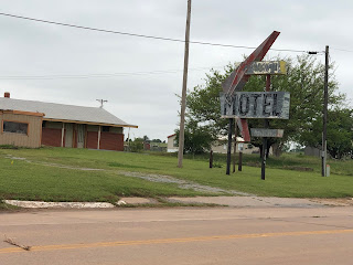
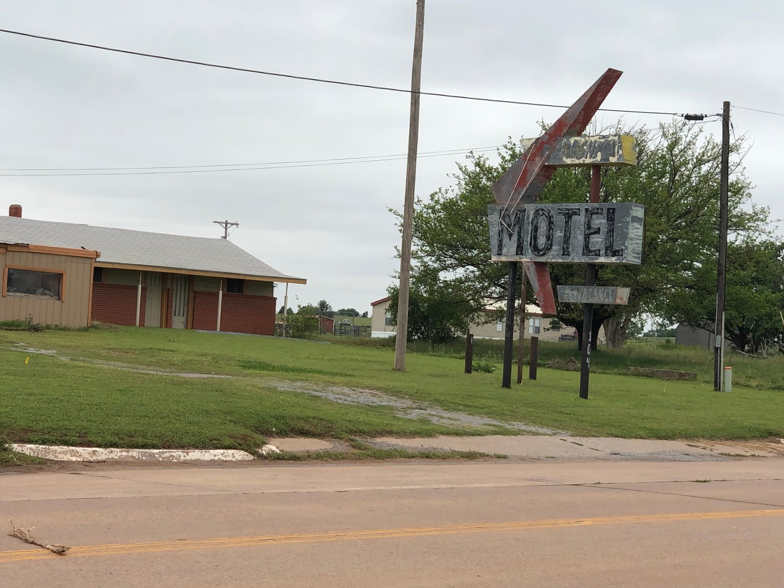
The town of Canute lives up to its name. It has failed to hold back the tide of progress and is a melancholy ghost-town.

Elk City is the last largish town before the Texas border and has the National Route 66 Museum, so I stayed there for the night.
 |
| The ubiquitous, now defunct, movie theatre in Elk City |


 However, Yukon is also the town where the Chisholm Trail, running north, crosses Route 66, running west. The Chisholm trail was developed to drive cattle from Texas to Kansas and the northern states.
 The drive to the fort is through land owned by US Department of Agriculture, where they research farming methods. The country is open and unfrequented and the drive westwards for some miles beyond here is great for spotting wildflowers and birds. This is a scissortail flycatcher - poor picture as the light was not good and they tend to fly just out of maximum zoom of an Iphone. Their tails are ridiculously long, as if they are flying a little kite behind them. They have grey upper parts and bright yellow bellies.


No comments:
Post a Comment