
Dinosaurs figure prominently in much of the roadside advertising, which offers mostly petrified wood. There are dinosaur fossils in Arizona, but I think the presence of the dinos suggests a confusion about the relative timescales of the formation of petrified wood and the age of dinosaurs.


The Wigwam Motel dates from the 1950s and was built by the current owners. Each of the eight wigwams has a vintage car parked outside. This is one of two remaining Wigwam or Teepee Motels along 66, of the seven built.


Along 66 there have been cattle (thousands of them), goats and llamas. Why not alpaca too? I donated the dollar requested to take a photo.

 These are the remains of an old Trading Post, once called Howdy Hawks, who you can see still standing on his verandah, no doubt hoping that his fortunes will change.
 If you have ever wondered how a split-log cabin is built, the mechanics are revealed here in this abandoned Post.
As most of 66 has been overtaken by I40 or is impassable, you have to join I40 for quite a few miles in Arizona. This makes for faster driving, but amongst the scary trucks going at 80 mph and attempting to overtake each other on uphill gradients. After 8 miles on I40, you reach Joseph City, where you exit back on old 66. Signs lead you to the Jack Rabbit Trading Post.


This is Cindy Juanez who runs it with her husband. They sell Route 66 souvenirs and handmade Native American jewellery, fetishes (small carved stone figures) and kachina dolls plus a bunch of other stuff, including rabbit milk. In fact, you could buy enough stuff for a life-time in these trading posts. I more or less resisted. They also have a room full of assorted Route 66 memorabilia, including an impressive number of coke bottles, and a cabinet full of rabbit-themed china ornaments.
Ok - not rabbit milk. It is condensed cows' milk, differently packaged.


To get to the next town, Winslow, you have to rejoin I40 for about 10 miles. Winslow is quite famous, but why is a mystery, until these guys are pointed out to you Got it?
"Well I'm a standin' on a corner in Winslow, Arizona.....Take it Easy". The Eagles, whom I saw in Oxford in 1972, by the way. Just sayin'.

At the intersection is a large US 66 sign and this old bank building, which is now a coffee shop selling a pretty good latte.
Winslow is an Amtrak stop, and the centre of the Santa Fe railroad's operations in Arizona. The station hotel, La Posada, has been restored. It was built in 1928 by architect Mary Colter. Take a look at the website, which is worth reading for an account of Colter's architectural vision for the hotel and how it was saved from demolition. La Posada history

There are many native varieties of evening primrose in the US. Here is the third seen on this trip (white, yellow, now pink), here planted by the township.
 |
| Showy evening primrose Oenethera speciosa |
 |
| A board claims that this is "the World's smallest church" |
There follows almost 40 miles of I40. On the way, I pulled off at Meteor City Road, to take a look at a former Post which apparently featured in the 1984 John Carpenter film "Starman", which stars Jeff Bridges and Karen Allen (best known for the Indiana Jones movies). Bridges is an alien who responds to an invitation to visit earth sent with the Voyager 2 space probe. Good fun. The geodesic dome is now rather battered.


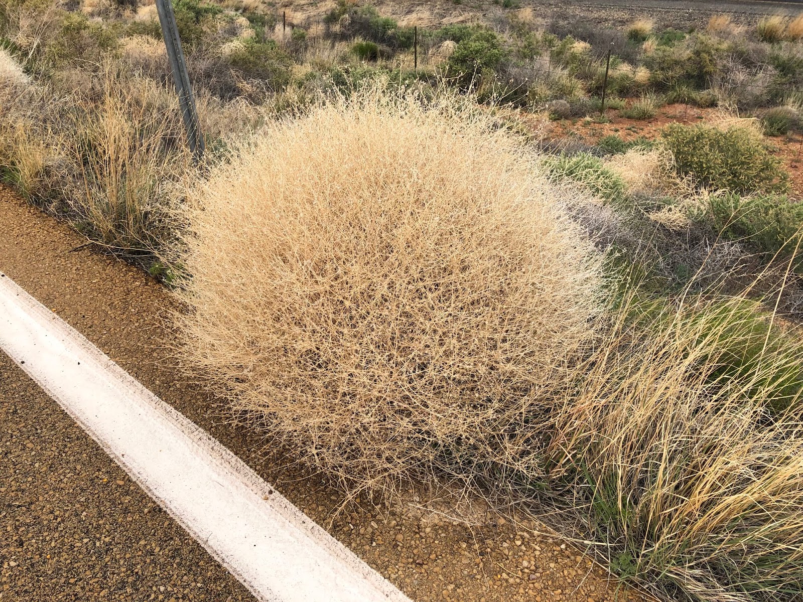
This is tumbleweed, or Russian thistle. it is not yet in flower here, but you can see the new green plants alongside the dead ones that have not detached from their roots and tumbled. It is not native to America, but arrived in consignments of seed from Europe in the 19th century. Its tumbling is a way of dispersing its seed. It is everywhere, but I haven't seen any tumbling yet.

"Meteor City" refers to the site of a massive meteor crater which can be visited a few miles further west. It is worth seeing, but I have been on a previous trip.
I40 runs across the high desert plain of Arizona - flat, scrubby land that stretches to the horizon at about 6000 ft. Leaving I40 at Winona, the road quickly climbs into the forested slopes that form the foothills of the San Francisco Mountain range, the highest peak in Arizona being Mt Humphreys at 12600 ft. This area is part of the Coconino National Forest which stretches from north and east of Flagstaff, south to Phoenix - an area of 1.856 million acres.
This splendid girder bridge, closed to traffic, is just off I40 at Winona.

 |
| The forested foothills of the San Francisco range. |
Flagstaff lies in the foothills of the mountains. It has a complex one-way system and a lot of traffic, which defeated me, so I saw very little. I also wanted to take a side-trip to Sedona, south of Flagstaff, which had been recommended to me by the hotel receptionist in Holbrook. The weather was awful. Pouring with rain, hailstorms and the temperature was down to 41F, so the pictures are limited and poor quality.
I had few expectations of what I would see, and indeed the first few miles on 89A, running parallel with 17, ran through the Coconino National Forest. The sign prohibiting vehicles over 50ft in length should have given me a clue. The land quite suddenly drops away into a deep canyon, formed by the Owl Creek, exposing towering red hills. The road switch-backs down, descending around 2000ft to Sedona. It is like driving down into the Grand Canyon, but with more trees.
My father was a man who had little time for rules and regulations. Prohibitions were for other people. He infuriated Fred by giving James red smarties, which at the time still had tartrazine in them, now banned in the EU. I was reminded of him when this happened. So much for the ban on vehicles over 50 ft.

We crawled down until eventually, the cruiser found a space to pull off.


 |
| Bridge carrying the road over the gorge formed by Owl Creek |

Sedona is a bustling tourist town, thronged with visitors in spite of the miserable, cold weather. It has the usual souvenir shops plus numerous cafes and restaurants. The buildings are mostly built of the local red stone.
 |
| Sedona |
I retraced my journey back to Flagstaff and headed west to Williams towards Williams. There is a short stretch of gravelled old 66, which I took, through the forest with views of the San Francisco mountains.


You have to take I40 for the final couple of miles into Williams, gateway to the Grand Canyon, where I spent the night.
No comments:
Post a Comment